

Crinkle Crags - Third Crinkle [Gunson Knott]
Good walks are even better shared.
NY2404 : Long Top summit cairn and Bowfell Links
Ian Greig Photo source
Overview
Crinkle Crags - Third Crinkle [Gunson Knott]
The Third Crinkle, affectionately known to locals as Gunson Knott, is a proud sentry in the Lake District, elevating hikers to some of the most breathtaking views in England. With an elevation of 859 meters, it is not the tallest among its siblings, but it surely packs a visual punch.
Geology
Crinkle Crags are primarily composed of coarse-grained volcanic tuff, combined with some sandstone and slate deposits. The mountain showcases classic glacial features, evidence of its powerful history, making it an interesting place not just for hikers but for geologists and enthusiasts alike.
Routes
One of the most popular routes, The Band, kicks off at the village of Stool End. Over the course of approximately 10 km, hikers will face rocky terrains and steep ascents that reward with spectacular vistas. Allow around 4.5 hours—your legs will feel like jelly by the end, but the views will be worth every step!
Summit Features
At the pinnacle, you’ll find a humble stone cairn - a beacon amongst the clouds. As you take a well-deserved rest, soak in the panoramic views of Bowfell, the Langdale Pikes, and the shimmering tarns below. On a fine day, the sight will make you momentarily forget about that extra biscuit you sneaked in your rucksack.
Terrain Type
The terrain is a mix of rugged and rocky sections, combined with gentler grassy slopes. Be prepared for a proper hike; this isn't your local park stroll!
Views
The summit promises breathtaking landscapes that stretch as far as the eyes can see. Peak highlights include Bowfell and the iconic Langdale Pikes. Spring and autumn are particularly splendid, offering crisp air and clear skies—that's the best time to capture those Instagrammable snaps!
Hazards
Be mindful of loose rocks on steep ascents and sudden weather changes typical of the Lake District. Those clouds can roll in faster than you can say ‘I should have checked the forecast!’. Stay hydrated and keep an eye on the grey skies!
Nearby Summits
Crinkle Crags isn't alone in its majesty. Close neighbours include the First Crinkle and the notably higher Bowfell, creating a stunning backdrop for your hiking adventures.
Access & Facilities
Accessible parking is available at the Old Dungeon Ghyll Hotel, with regular bus services from Ambleside. After your grueling hike, the hotel is a haven for food, drink, and restrooms—absolutely essential!
History
The name Crinkle derives from the Old Norse word for 'wrinkle', fittingly describing the craggy silhouette of the mountain. Historically significant, the Lake District has provided inspiration for poets, with its majestic landscapes captured pen in hand, encouraging many to explore the wonders of nature.
So, lace up your boots, grab your best hiking pals, and set forth to explore the wonders of Crinkle Crags. Who knows, you might even find a secret route or two—just don’t forget to share the biscuits!
Explore routes near Crinkle Crags - Third Crinkle [Gunson Knott]
Walks starting near this hill. Open a route to check its map, distance and full itinerary.
Great Carrs Halifax Wreckage from Wrynose Pass
View route
Bow Fell from Langdale
View route
Scafell Pike via Brown Tongue and Hollow Stones
View route
Scafell Pike from Seathwaite via the Corridor Route
View route
Route planning notes
These notes describe possible approaches. Check a route's map and access information when planning your walk.
Crinkle Crags via The Band
This classic route begins in the village of Great Langdale at the Old Dungeon Ghyll Hotel. Follow the path up The Band, a prominent ridge offering excellent views, before reaching the base of Bowfell. From here, turn southwest to ascend the Crinkle Crags ridge, tackling the famed 'Bad Step' along the way. Descend along the ridge to Gunson Knott (Third Crinkle), before looping back into the valley via Oxendale Beck.
Crinkle Crags and Bowfell Circular
Start from Great Langdale and ascend via Oxendale Beck passing Red Tarn. Climb Crinkle Crags ridge, including Gunson Knott, and continue along to Bowfell. Descend via Three Tarns and The Band, completing a spectacular circular route with varied terrain and stunning views of the Langdale Valley.
Crinkle Crags via Red Tarn
This shorter route starts at the Old Dungeon Ghyll Hotel and follows Oxendale Beck up to Red Tarn. From the tarn, ascend the Crinkle Crags ridge to Gunson Knott, enjoying panoramic views of the surrounding peaks and valleys. Descend back the same way for a more direct outing.
Crinkle Crags from Wrynose Pass
This route offers a quieter approach starting from the top of Wrynose Pass. Follow the path up towards Red Tarn and join the Crinkle Crags ridge. Gunson Knott (Third Crinkle) is reached along this stunning ridge walk. Retrace your steps or make a loop by descending via Cold Pike.
Crinkle Crags from Cockley Beck
A remote and less trodden route starting from Cockley Beck Bridge. Ascend along the River Duddon before climbing towards Great Knott. Continue onto the Crinkle Crags ridge, reaching Gunson Knott. Retrace your steps or descend via the same ridge for a peaceful outing.
Make a day of it, together
Find someone to share the walk with, or organise a day out along a route you like.
Photo Gallery
View all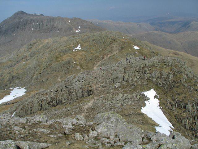 Photo could not load
NY2405 : The Crinkle Crags Ridge
K A
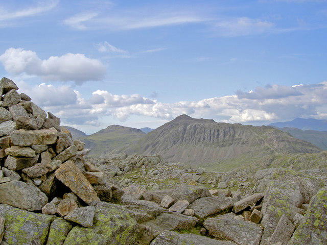 Photo could not load
NY2404 : The summit cairn of Long Top
Ian Greig
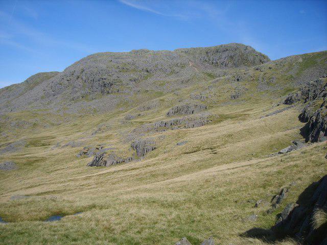 Photo could not load
NY2404 : Adam a Cove
Michael Graham
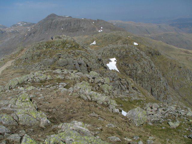 Photo could not load
NY2405 : The Crinkle Crags Ridge
K A
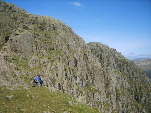 Photo could not load
NY2404 : On Crinkle Crags
Michael Graham
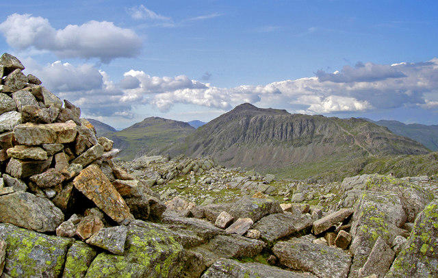 Photo could not load
NY2404 : Long Top summit cairn and Bowfell Links
Ian Greig
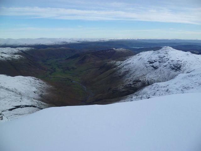 Photo could not load
NY2405 : Cornice near Gunson Knott
Michael Graham
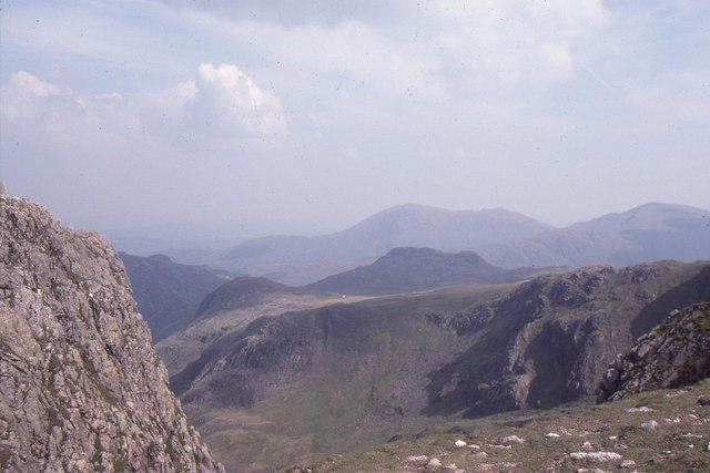 Photo could not load
NY2404 : Summit of Crinkle Crags: view towards Coniston Fells
Christopher Hilton
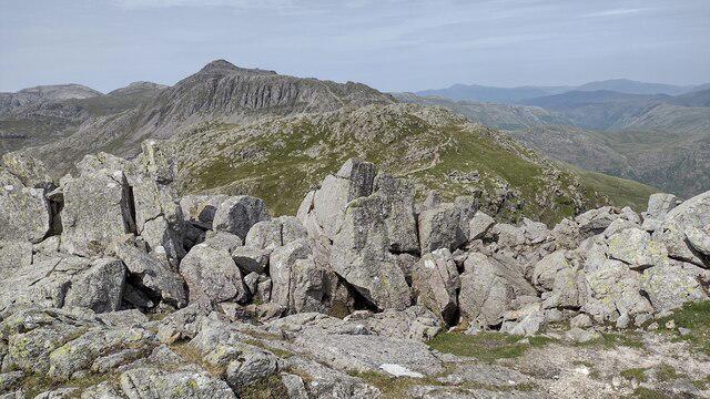 Photo could not load
NY2405 : Crinkle Crags
Shaun Ferguson
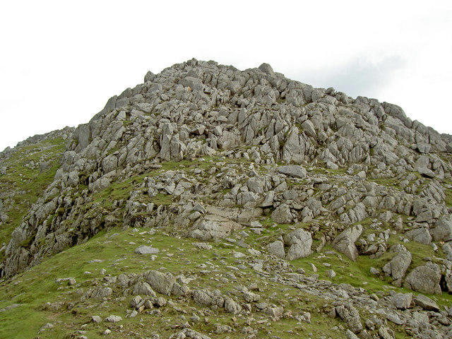
NY2505 : Gunson Knott
Ian Greig
Hill facts and local notes
Classifications
Elevation
840m
2,756 ft
Prominence
14m
Coordinates
54.4347, -3.1577
NY250049
OS Map
89 90
Explorer: OL6N
At the Summit
The summit boasts a small stone cairn, with stunning panoramic views of the surrounding peaks and valleys.
Terrain & Geology
Predominantly formed of coarse-grained volcanic tuff, with some sandstone and slate deposits. The crags exhibit classic glacial features, including striations and sharp ridges.
Views & Scenery
From the summit, you can see Bowfell, Langdale Pikes, and the shimmering waters of the nearby tarns.
History & Heritage
Name Origin
The name 'Crinkle' comes from the Old Norse for 'wrinkle', referring to the mountain's craggy outline.
Historical Significance
Part of the historical Lake District, a site of significance during the Romantic period for its stunning scenery and inspiration for poets and artists.
Getting There & Facilities
Parking
Parking is available at the Old Dungeon Ghyll Hotel in Langdale.
Public Transport
Regular bus services from Ambleside to Langdale, with a stop at the Old Dungeon Ghyll.
Nearby Facilities
The Old Dungeon Ghyll Hotel offers food, drink, and restrooms.
Safety Information
Known Hazards
- Loose rocks on steep ascents, sudden weather changes, and potential for slippery conditions in wet weather.
General Safety Tips
- Check weather conditions before setting out
- Carry appropriate clothing and equipment
- Let someone know your planned route
- Take a map, compass, and GPS device
- Carry emergency supplies: food, water, first aid kit, torch
Hills
Some common questions about the hills answered
Are there group walks up Crinkle Crags - Third Crinkle [Gunson Knott]?
Many walkers use Walkmates to join or organise walks with others. You can check for group walks around Crinkle Crags - Third Crinkle [Gunson Knott] through the maps
Are there other walkers around Crinkle Crags - Third Crinkle [Gunson Knott]?
Activity varies by location and time, but Walkmates lets you see whether others have shared walks or shown interest in this area. Find other people through the walking friends search walking friends for Crinkle Crags - Third Crinkle [Gunson Knott] search or of course create your own walk for Crinkle Crags - Third Crinkle [Gunson Knott]
Can I organise a walk to Crinkle Crags - Third Crinkle [Gunson Knott]?
Yes. If there aren’t any walks listed already, you can create a walk and make it available for others to join.
If you're signed up to Walkmates, you can create a walk to Crinkle Crags - Third Crinkle [Gunson Knott].
How do I find a walk up this hill?
There are often multiple ways to walk this hill, depending on experience and route preference. Walkmates helps you explore walks and routes that others have shared.
Can I suggest a new route up Crinkle Crags - Third Crinkle [Gunson Knott]?
Yes. You can suggest or create routes to share with others. Walkmates focuses on the social side of walking, so routes are used to help people organise walks and explore areas together, rather than as detailed navigation tools or route libraries.
Other uses really appreciate knowledgeable walkers sharing their routes. Share your favourite route to Crinkle Crags - Third Crinkle [Gunson Knott] here
The is an error or something incorrect about this hill. How do I let you know?
We always strive to keep the information on Walkmates as accurate as possible. If you find an error, please let us know through the contact form and we'll aim to correct it as quickly as possible
Community Discussion
Comments
Location
![Crinkle Crags - Third Crinkle [Gunson Knott] location map](https://cdn.walkmates.com/hill-maps/hill-sources/2777/54.43471_-3.15770.png)
Grid reference: NY250049
View on OpenStreetMapOpens a map in a new tab, centred on the hill.
Nearby Hills
Crinkle Crags - Long Top [Second Crinkle]
859m
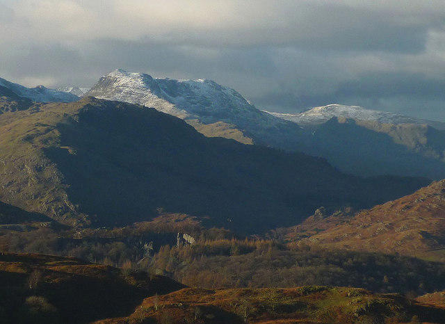
Bowfell
903m
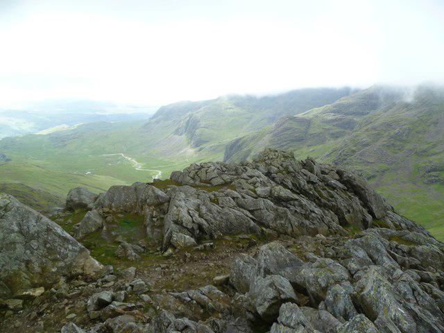
Esk Pike
885m
Pike of Blisco
703m
Hard Knott
550m
No comments yet. Be the first.